
Welcome to the Ada County Emergency Management & Community Resilience web site. This site contains information and resources related to disasters and emergency preparedness. Here you will find information about emergency management, disasters, hazards, and preparedness for families, businesses, and animals.
Our Vision
A secure and resilient Ada County involving the whole spectrum of public and private partners in building capabilities to prevent, protect against, mitigate, respond to, and recover from the threats and hazards that pose the greatest risk.
Our Mission
To coordinate and integrate all-hazards, comprehensive emergency management activities to ensure Ada County is a safe and resilient place to live, work, and play.
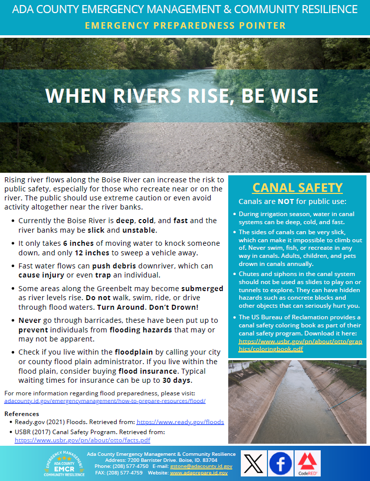
Monthly Emergency Preparedness Pointer